Home · Oil and Gas Software · Geosteering Software

NWE WellReport™ · Data — Partner Posture

Geosteering software is only as good as its survey data.

Let us be direct about what this page is — and is not. NWE WellReport is not a geosteering suite, and this page will not pretend otherwise. What it is: the directional drilling system of record that feeds geosteering platforms the cleanest data in the chain — accepted, QC-checked, versioned surveys, vertical-section position, and plan-vs-actual, from one ledger, built to be consumed.

The data problem

Great geosteering, fed by whatever file arrived last.

Geosteering platforms interpret the earth. Too often, the wellbore position they interpret from is the weakest data in the building.

The geologist's model is only as honest as the surveys beneath it. When those surveys arrive as emailed exports — re-saved, re-versioned, QC'd after the fact or not at all — the interpretation inherits every flaw in the chain, and the landing decision gets made on a position nobody can fully vouch for.

NWE WellReport's position in this workflow is upstream and proud of it: own the directional record — surveys accepted once, checked as they land, versioned in one ledger — and supply it cleanly to the geosteering suites, operator databases, and automation platforms that consume it. Distribution through partners' ecosystems, not a head-on feature war.

The data layer

What the geosteering stack actually needs from us.

The north star, in one line.Build the DD operating system — then make it the cleanest data source for every geosteering, operator, and automation platform around it. That is the strategy this page serves: the working directional workflow, feeding one ledger, that every consumer upstream can trust.

01 / THE RECORD

Position data with a chain of custody.

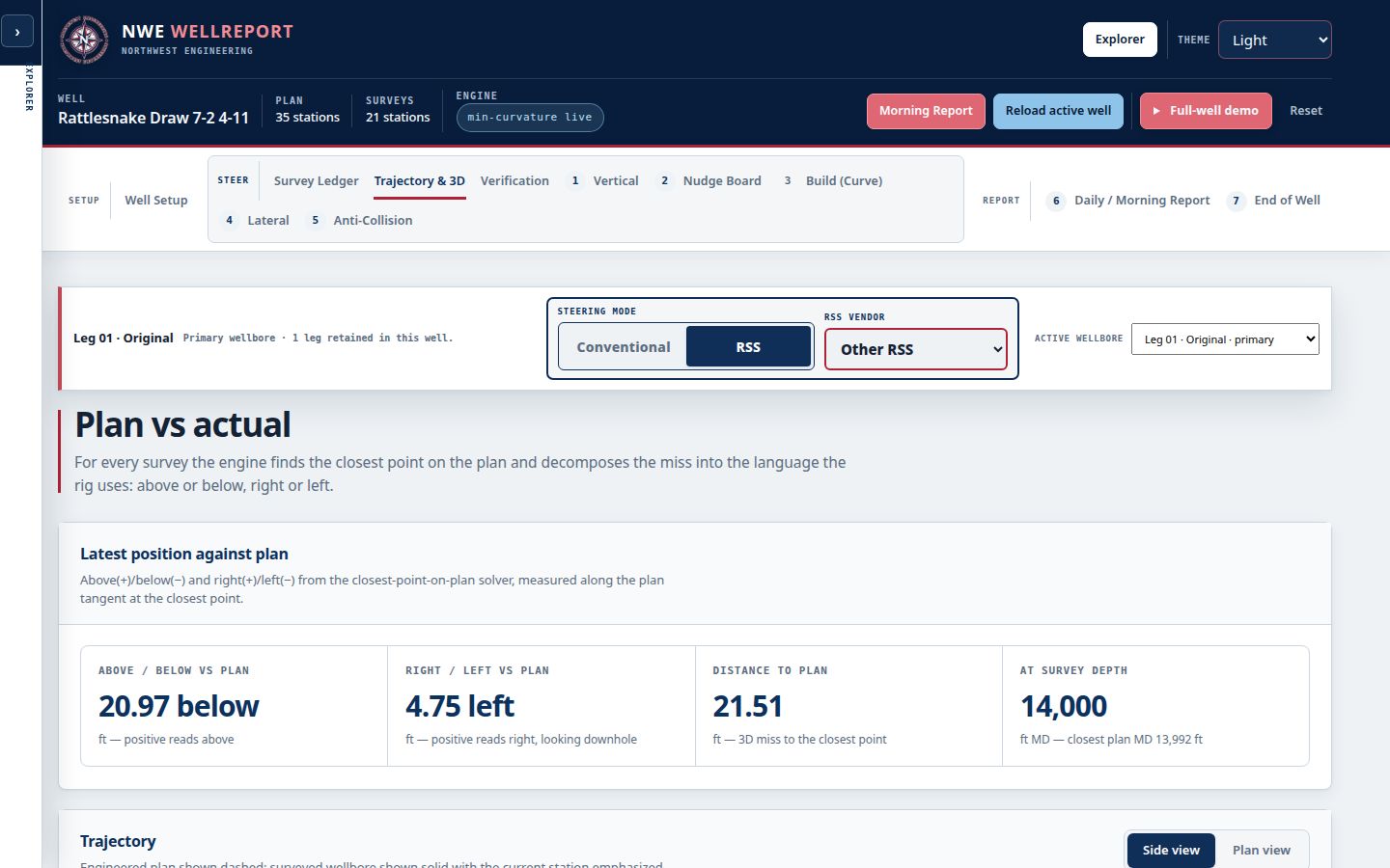
Every station in the ledger is accepted once, solved by minimum curvature, and QC-checked at acceptance — projection discrepancies, high dogleg, out-of-tolerance stations flagged before they propagate. From that record come the products geosteering consumes: the definitive survey, vertical-section position, above/below and left/right relative to plan, and continuous plan-vs-actual against the stage-based plan.

  • Accepted, QC-checked surveys
  • Vertical-section position data
  • Continuous plan-vs-actual
Live NWE WellReport Directional Drilling workspace with the survey record geosteering data comes from
02 / BUILT TO BE CONSUMED

Open by design, from day one.

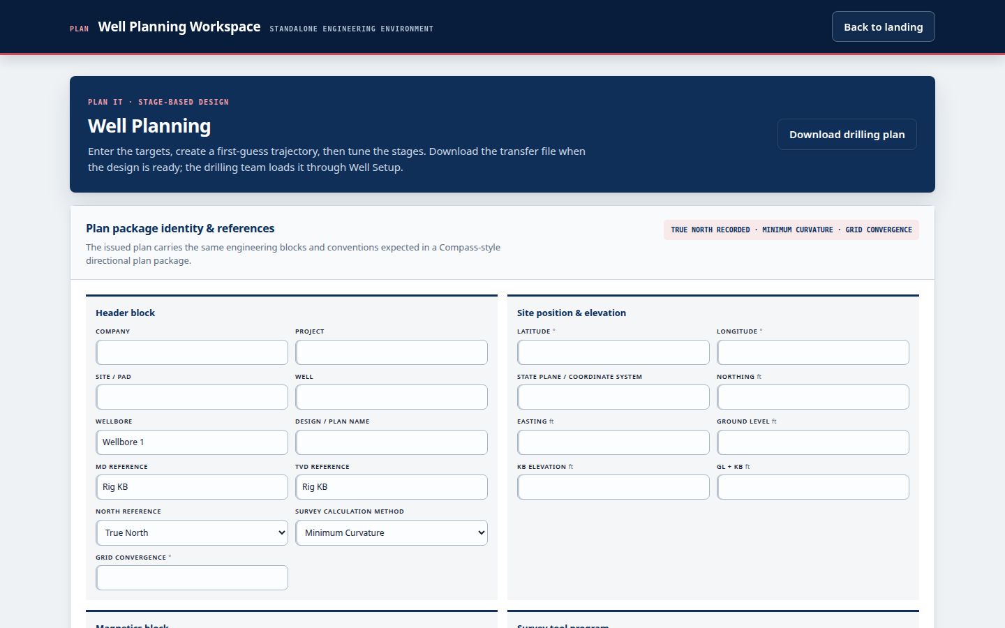
The platform is designed as a data source, not a silo: an open API and an OSDU-compatible data model from day one, so geosteering suites, operator databases, and automation platforms read NWE data natively instead of scraping exports. Today the record supplies clean survey exports in the standard formats; the API is the production direction, built into the architecture rather than bolted on.

  • Survey exports in standard formats today
  • Open API — production direction
  • OSDU-compatible data model
Live NWE WellReport workspace showing the well record built to be consumed downstream

How the data flows

Accepted once. Trusted everywhere.

01

Surveys are accepted.

Stations enter the ledger once — typed at the rig or imported with accept/reject review — and are QC-checked as they land.

02

Position is computed.

The full solution, vertical-section position, and plan-vs-actual are maintained continuously from the accepted record.

03

Consumers read it.

Geosteering platforms, operator databases, and reports draw from the same definitive record — exports today, API as production lands.

04

Corrections stay corrections.

The ledger is versioned: an amended survey is a new version with its history, never a silent overwrite nobody can audit.

Deliverables

The cleanest input in the chain.

We supply the position. You steer the geology.

Everything below is data the directional record produces for the platforms and professionals who consume it — with the acceptance and QC history attached.

  • Definitive survey record
  • Vertical-section position
  • Above / below, left / right of plan
  • Plan-vs-actual, continuous
  • Distance from plan
  • QC flags and acceptance history
  • Survey exports (txt / Excel / PDF)
  • Open API / OSDU direction
Clean data · for every platform

Where it stands

Positioned honestly, on purpose.

What NWE WellReport is not.Not a geosteering suite: we do not draw the geology, interpret the logs, or call the landing. Those decisions belong to geologists and their platforms — and those platforms deserve better input than an emailed spreadsheet. Our claim is narrower and, we think, stronger: the most trustworthy directional data source those tools can consume.

Where it stands.The ledger, the QC, and the exports are in founding field testing today. The open API and OSDU-compatible consumption layer are architectural commitments being built with the production backend — stated as direction, not inventory. Partners who consume directional data are welcome at the table now, while the interfaces are being set.

Common questions

Questions, answered straight.

Is NWE WellReport a geosteering software suite?

No — and we say so on purpose. NWE WellReport does not interpret geology or replace a geosteering suite. It is the directional drilling system of record that supplies geosteering platforms: accepted, QC-checked, versioned surveys and position data from one ledger. Geosteering software is only as good as its survey data; supplying that data cleanly is our side of the workflow.

What geosteering data does it supply?

The products of the accepted survey record: the definitive survey with its full minimum-curvature solution, vertical-section position, above/below and left/right position relative to plan, continuous plan-vs-actual, and distance from plan — each with its QC and acceptance history, so a consumer can see not just the position but how much to trust it.

How do geosteering platforms get the data?

Today, through clean survey exports in the standard formats the industry already exchanges. The platform is designed for more: an open API and an OSDU-compatible data model from day one, so geosteering suites, operator databases, and automation platforms can consume NWE data directly as the production backend lands — distribution through partners' ecosystems rather than another silo.

Why does survey QC matter to geosteering?

Because interpretation amplifies input. A station with a projection discrepancy or an out-of-tolerance dogleg does not stay a small error once a landing decision is built on it. Checking every survey as it is accepted — and versioning the record so corrections are auditable — is what makes the position underneath the geology worth interpreting at all.

Who is this page for?

Two readers: the geosteering and operator teams who consume directional data and are tired of vouching for emailed exports — and the directional companies whose data feeds those platforms, who gain a record their customers can trust. If your platform consumes surveys, we would rather be your best supplier than your loudest rival.

Founding pilots now open

Put it on real wells.

Bring your current workflow, your survey exports, and your field team. We verify the math against your current software before your team relies on it in the field, train your DDs, review what works, and make anything that does not work right.

$5,000First year · up to 5 wellsTalk to us about a pilotExplore the live platform